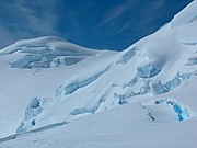
Aheloy Nunatak
Antarctic Island mountain peakAheloy Nunatak is a rocky 390m peak in the upper Huron Glacier in Livingston Island. The peak forms the northeast extremity of a minor ridge which also features Erma Knoll and Lozen Nunatak, and is linked to Zograf Peak by Lozen Saddle. The peak was first visited on 31 December 2004 by the Bulgarian Lyubomir Ivanov from Camp Academia, and was mapped in the Bulgarian Tangra 2004/05 topographic survey. The peak was named after the Black Sea town of Aheloy, Bulgaria.
Read article
Top Questions
AI generatedMore questions
Nearby Places

Erma Knoll
Peak in Antarctica

Komini Peak
Mountain in Antarctica

Lozen Nunatak

Lozen Saddle

Ravda Peak
Rocky peak in the South Shetland Islands, Antarctica

Shipka Valley
Valley in the South Shetland Islands

Zograf Peak
Peak in Antarctica

Huron Glacier
Glacial flow on Livingston Island in the South Shetland Islands, Antarctica


